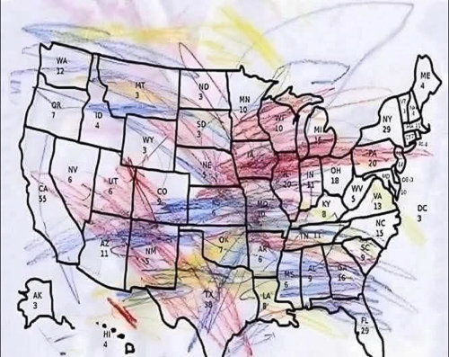
| So much for global warming, darn it. |
[WashingtonPost] Here’s a daily overview of expected conditions:
FRIDAY
Snow and ice are forecast to develop in a stretch from South Dakota to northern Texas during the day on Friday, spreading eastward from Arkansas to Alabama overnight. Accumulating snow will also hit drought-affected states such as Wyoming, Colorado and New Mexico, some of the snow heavy, with lesser amounts for Utah and Arizona.
SATURDAY
The storm will continue its eastward trek while worsening Saturday, reaching the Mid-Atlantic at night.
More than 100 million people will experience the storm simultaneously as it hits some of the country’s major thoroughfares.
The day’s worst weather will span from New Mexico to the Carolinas, with heavy snow and/or ice along the Interstate 40 corridor — and significant ice accretion to the south along Interstate 30 and portions of Interstate 20. Snow will probably stretch as far north as the Interstate 70 corridor, reaching northward to Interstate 80 late in the day and at night.
Travel on most roads will be dangerous along and near those routes, including numerous cities such as Amarillo, Abilene, Fort Worth and Dallas in Texas; Oklahoma City and Tulsa; Fort Smith and Little Rock in Arkansas; Springfield and St. Louis in Missouri; Carbondale and Springfield in Illinois; Evansville and Indianapolis in Indiana; Cincinnati; Paducah, Bowling Green and Louisville in Kentucky; Memphis, Nashville, Chattanooga and Knoxville in Tennessee; Shreveport in Louisiana; Tupelo in Mississippi; Huntsville in Alabama; Dalton in Georgia; Greenville and Columbia in South Carolina; Asheville, Charlotte and Raleigh in North Carolina; Roanoke in Virginia; and Charleston in West Virginia.
# id) ?>

|